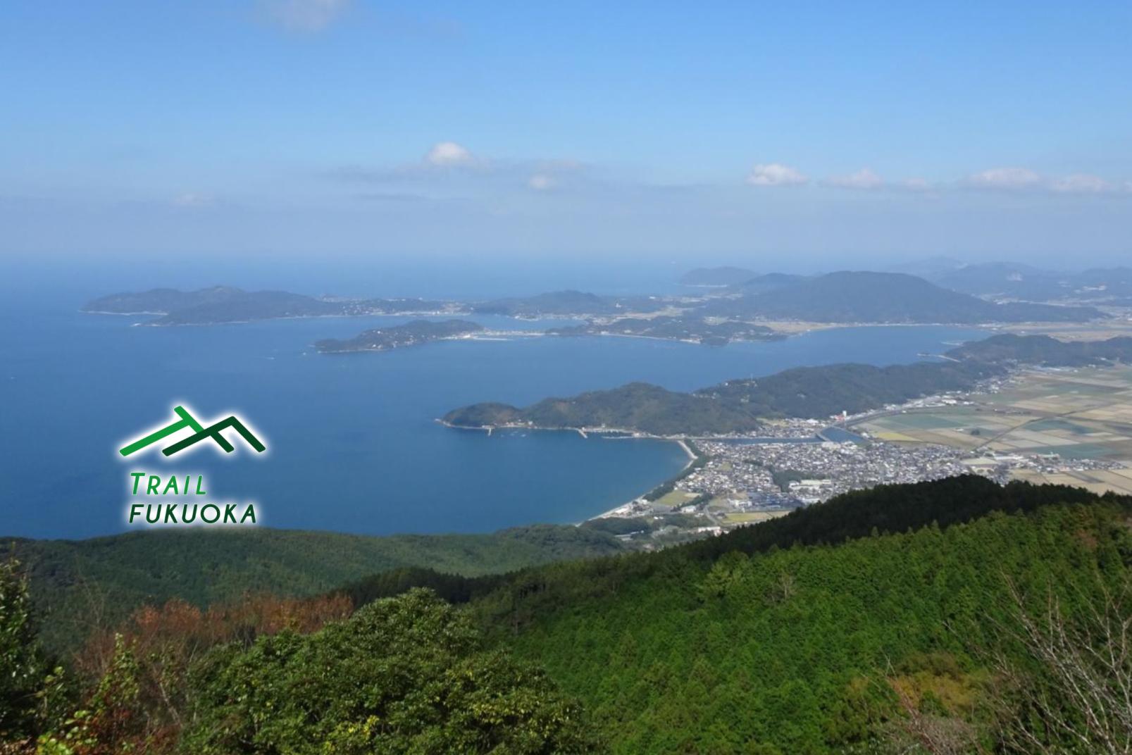
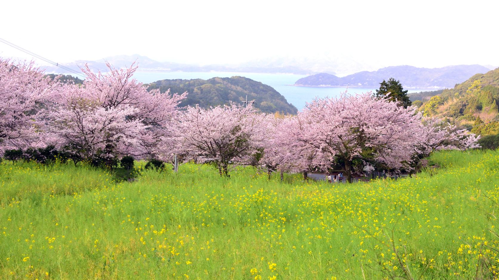
Mt. Nijodake
Standing at 711 meters, Mt. Nijodake is a middling peak among the Sefuri mountains, but it is one of the most scenic spots in Itoshima. Looking out over Genkai Sea, the sense of accomplishment from climbing to the top is exceptional. Halfway up the mountain is the Manago Kinoka Land Camping Ground, a base for recreational pursuits. From here, the Nijo Valley, which continues for about 2km, boasts fine autumn foliage so you can enjoy nature to the hilt during your hike. The four-mountain traversal route taking in Mt. Onnadake, Mt. Ukidake and Mt. Jubo is highly recommended for advanced climbers. For the detailed route, please see the map "Itoshima no Yama Aruki (Mt. Nijodake, Mt. Medake, Mt. Ukidake, Mt. Tonbo)" .
Location data
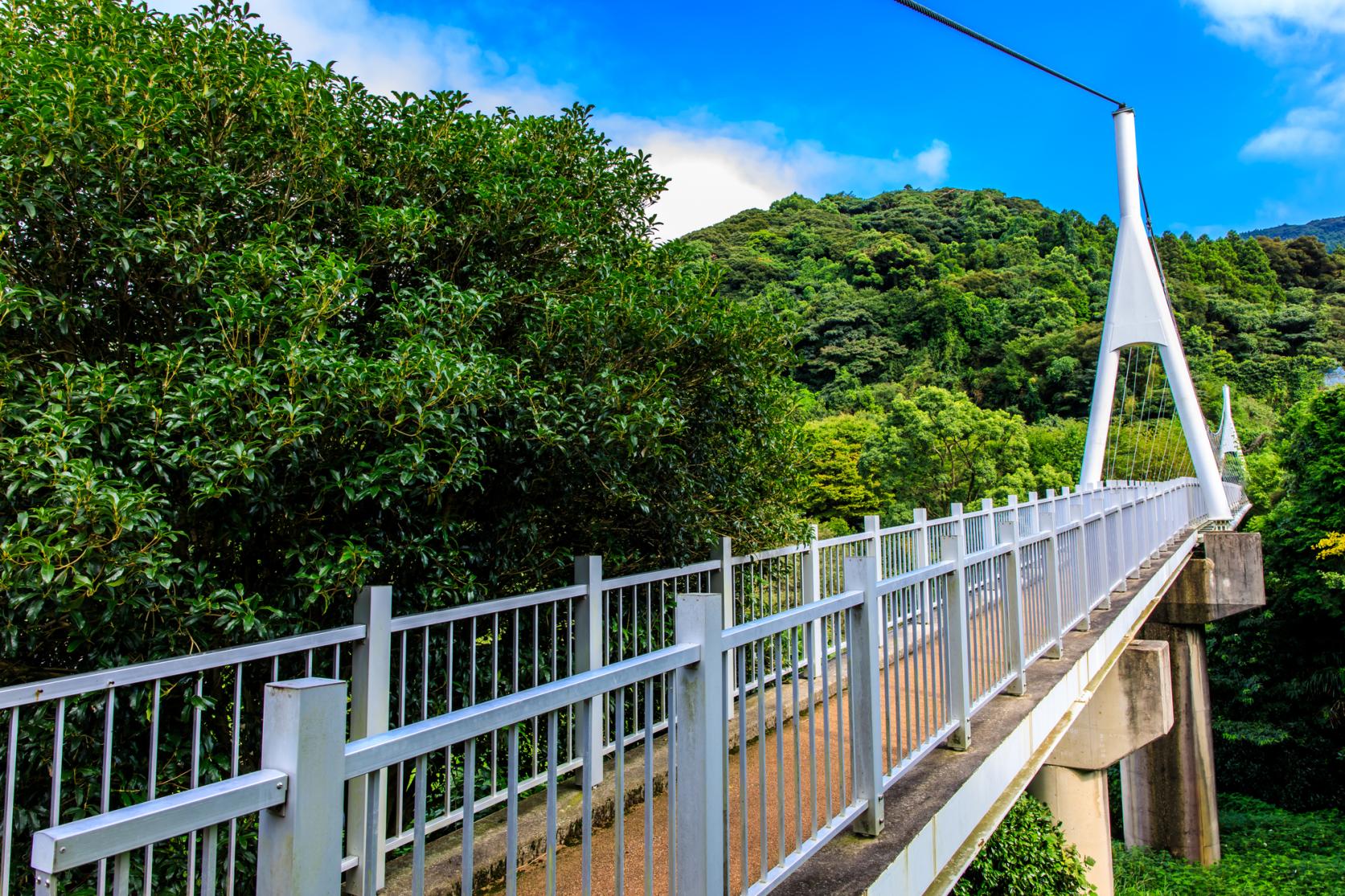
Kamo Yurarinko Bridge
35 minutes' walk to JR Dainyu Station. The climbing map "Itoshima Yama Aruki (Mt. Nijodake, Mt. Medake, Mt. Ukidake, Mt. Tonbo edition)" is available from the Yamanavi Box in the carpark.
■Amenities
Parking: Yes / Toilets: Yes / Water station: No / Camping: No
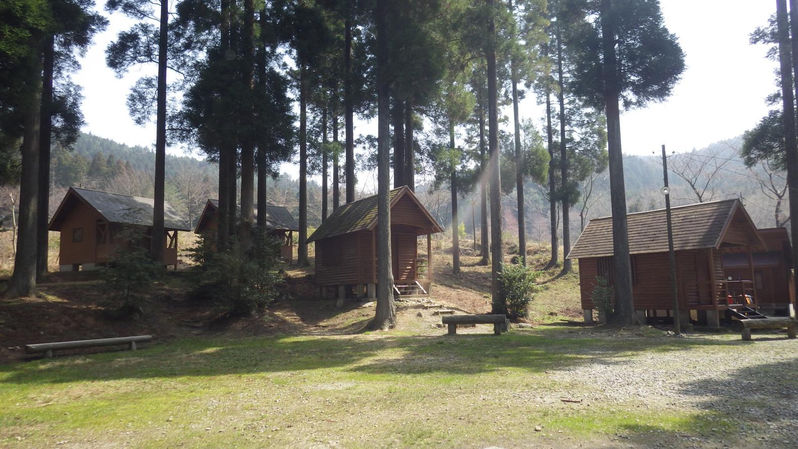
Manago Kinoka Land Camping Ground
A verdant nature park spread between mountains at an altitude of 400m, located up from Kamo Yurarinko Bridge on the Manago Forest Trail. Featuring bungalows, flushing toilets, showers and training faciliites, the amenities are excellent for the enjoyment of river swimming and barbeques.
■Amenities
Parking: Yes / Toilets: Yes / Water station: Yes / Camping: Yes
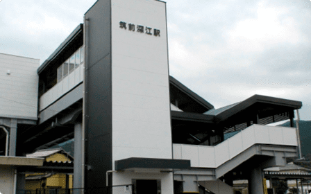
JR Chikuzen-Fukae Station
The current station building stands in the Fukae area, which flourished historically as a post station, and was redeveloped as a station built on the bridge in 2018. As a "meeting place", it warmly welcomes visitors.
■Amenities
Parking: No / Toilets: Yes / Water station: Yes / Camping: No
■Address
Nijofukae, Itoshima City
■Telephone Number
092-322-2521 (JR Chikuzen-Maebaru Station)
Sightseeing information
-
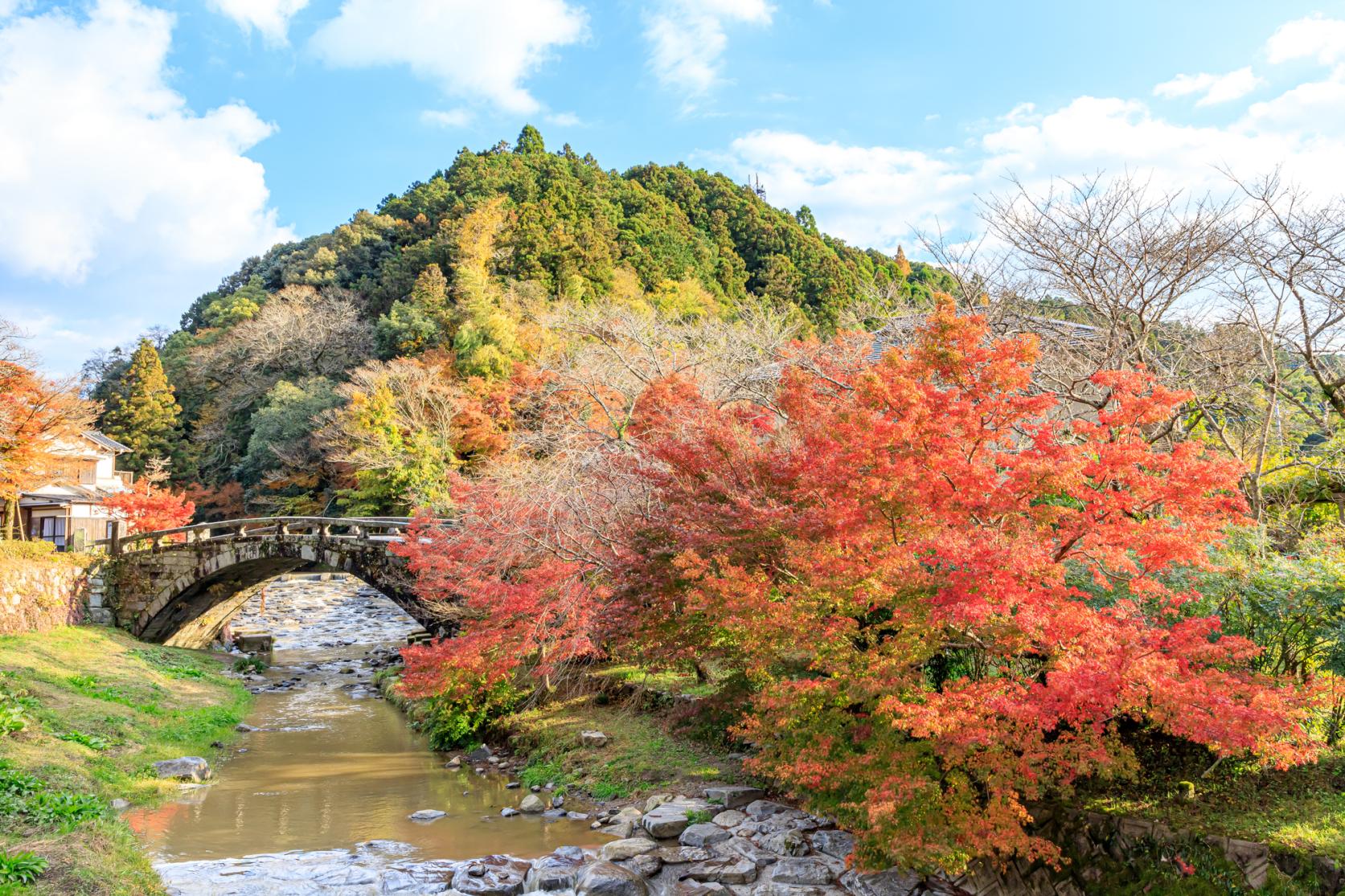
Kamo Yurarinko Bridge
View more (Japanese website)A 100m-long swingbridge spanning the upper Kamo River. It is one of the longest bridges in the world to be suspended from one wire only and the view down takes in the Nijo Valley stream, Genkai Sea, the Tanada rice terraces and more. This is a recreational area to immerse yourself in all of the four seasons.
-
Mt. Nijodake
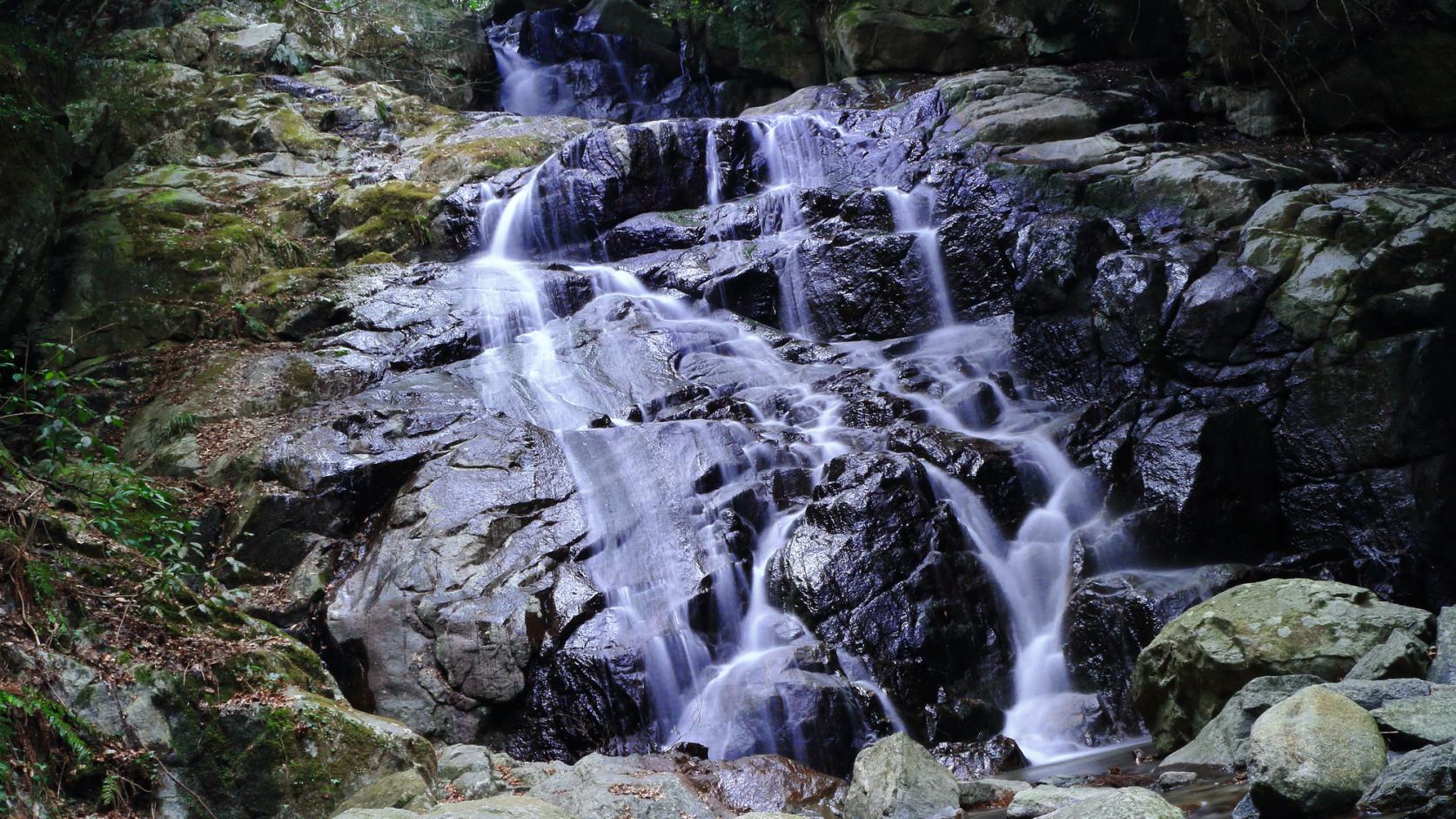
View more (Japanese website)The trail from Kamo Yurarinko Bridge to Kamo Shrine continues for about 2km and is an easy hike. Along the valley are the Myojin Falls, a popular spot to cool off. The foliage here in mid-November is highly recommended.
-
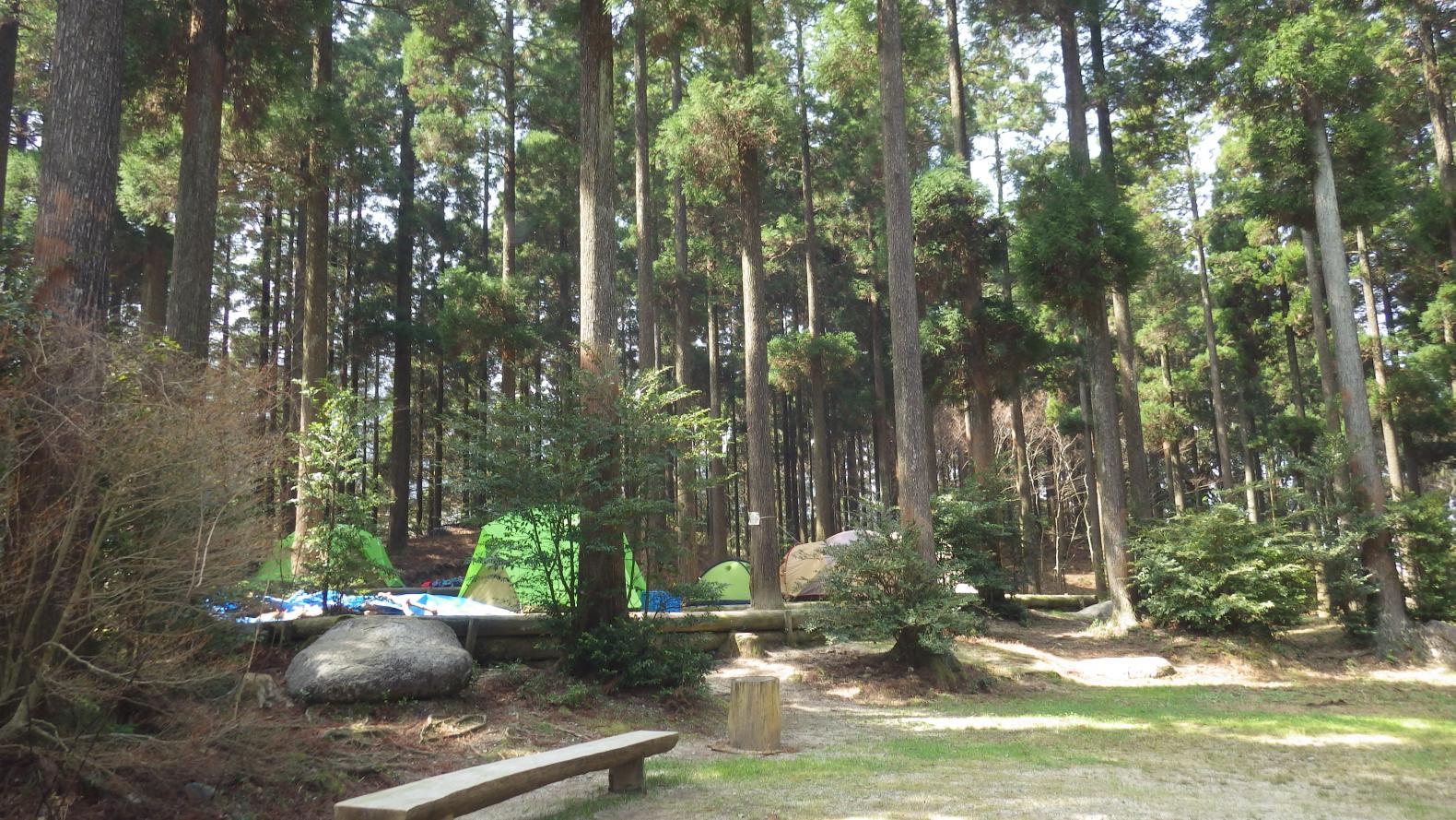
Manago Kinoka Land Camping Ground
View moreA park set amid cedar forest and deep green foliage. A stream invites swimming and in the summer holidays the campground is alive with children. This is the perfect environment for hands-on nature learning with well-maintained forests and walking trails as well as hiking to Mt. Nijodake and Nijo Valley.
-
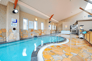
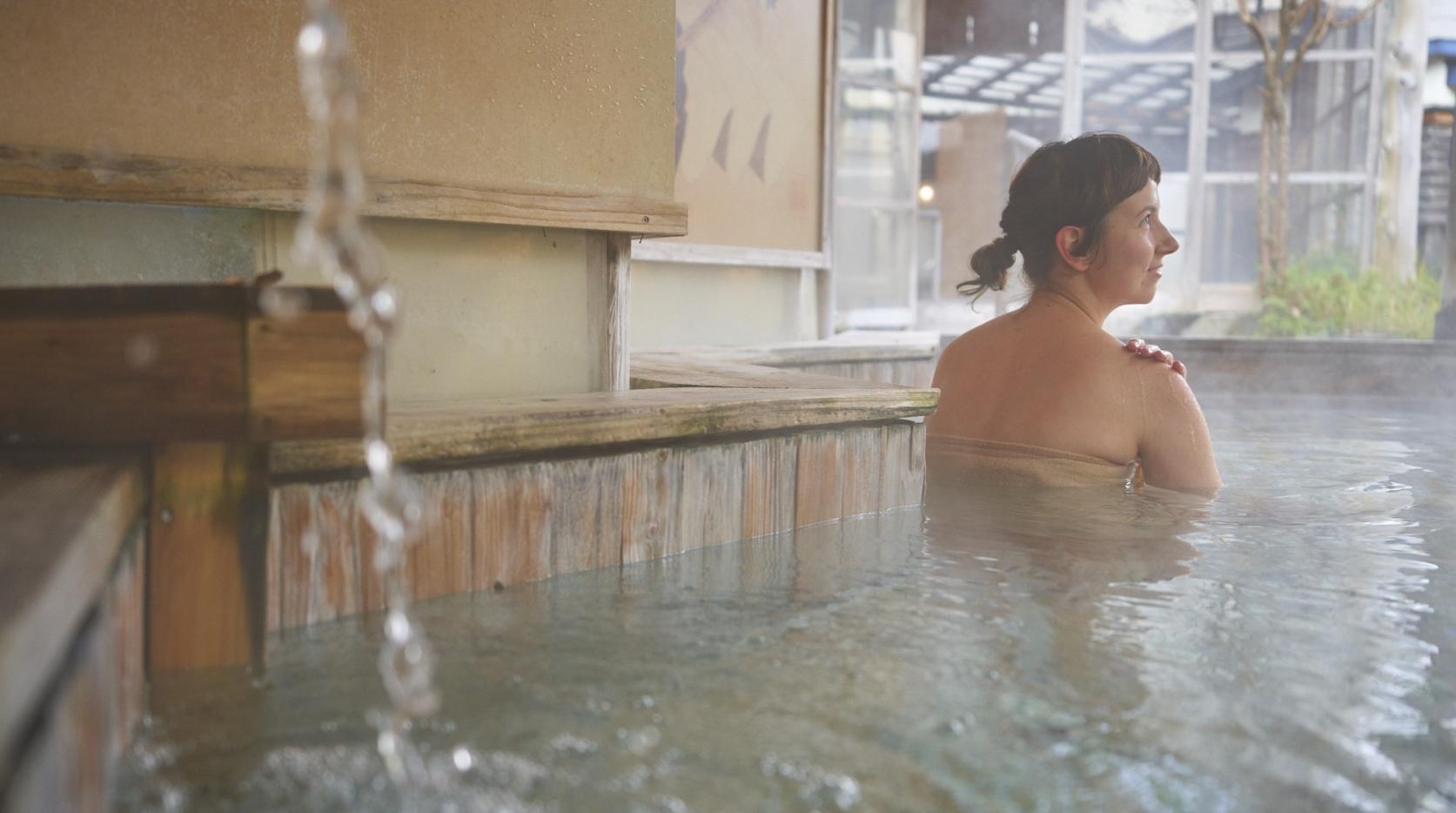
Kirara-no-yu, Nijo Onsen
View moreOne of the top radon hot springs in Japan and a tonic for sufferers of gout, rheumatism, neuralgic pain and more. There is also a tap to fill your bottles with radon springwater, a market with fresh vegetables and processed goods as well as an onsite restaurant reputed for its devotion to local produce.
-
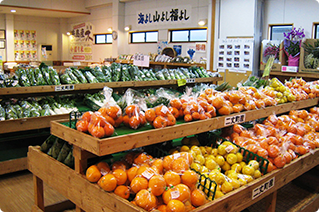
Fukuyoshi Fureai Exchange Center, Fukufuku no Sato
View moreThis shop offers freshly picked seasonal fruit and vegetables from the local district as well as fish just landed through Fukuyoshi Port. Not to be missed either are the soft-serve ice cream, juices and sweets made using Haruka citrus, a varietal developed right here in Fukuyoshi.
TRAIL MAP
Google Maps may not display correctly if left open for more than 1 day
- See more detailed hiking information (YAMAP) (Japanese website)
- See the map "Itoshima no Yama Aruki (Mt. Nijodake, Mt. Medake, Mt. Ukidake, Mt. Tonbo edition)" (Japanese website)
Share
 Next article for you
-
![[2026] Making the Best of Fukuoka's Summer—Fireworks and Summer Festivals-1](https://www.crossroadfukuoka.jp/storage/special_features/209/responsive_images/geUE4Uu530lhfOasCcXopZun4tuuSDtRyZcxw2Sl__1669_757.jpg)
[2026] Making the Best of Fukuoka's Summer—Fireworks and Summer Festivals
-
【2025】Your Guide to Fukuoka Prefecture's Best Fall Foliage Destinations
-
Fukuoka Has Onsen Too! A Complete Guide—from Day Trips to Famous Hot Springs
-
TIPS FOR TRAVELING IN FUKUOKA PREFECTURE
-
10 Recommended Dishes in Fukuoka! Discovering the Region’s Finest Foods
-
Kids will love it too! Recommended spots for family trips in Fukuoka Prefecture
-
15 Recommended Parks in Fukuoka: Everything from Playing, Sports, and Walking to Spectacular Views♪
-
10 Recommended Shrines and Temples in Fukuoka!
-
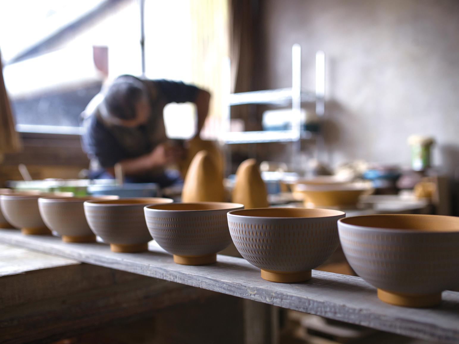
TRADITIONAL JAPANESE CRAFTS OF FUKUOKA ~Present Day Breath-taking Craftsmanship~
-
Admiring the Best Scenery that Nature Has to Offer in Itoshima
-
A Guide to Major Tourist Events and Festivals in Fukuoka Prefecture in February
-
![[2026] Strawberry Picking Spots in Fukuoka-1](https://www.crossroadfukuoka.jp/storage/special_features/49/responsive_images/9ZHgrqvQdpH8tM4IRF54DXu0aPBF3YGGkj5WOTGc__1673_1115.jpg)
[2026] Strawberry Picking Spots in Fukuoka
-
How to experience Mojiko Retro in Kitakyushu
-
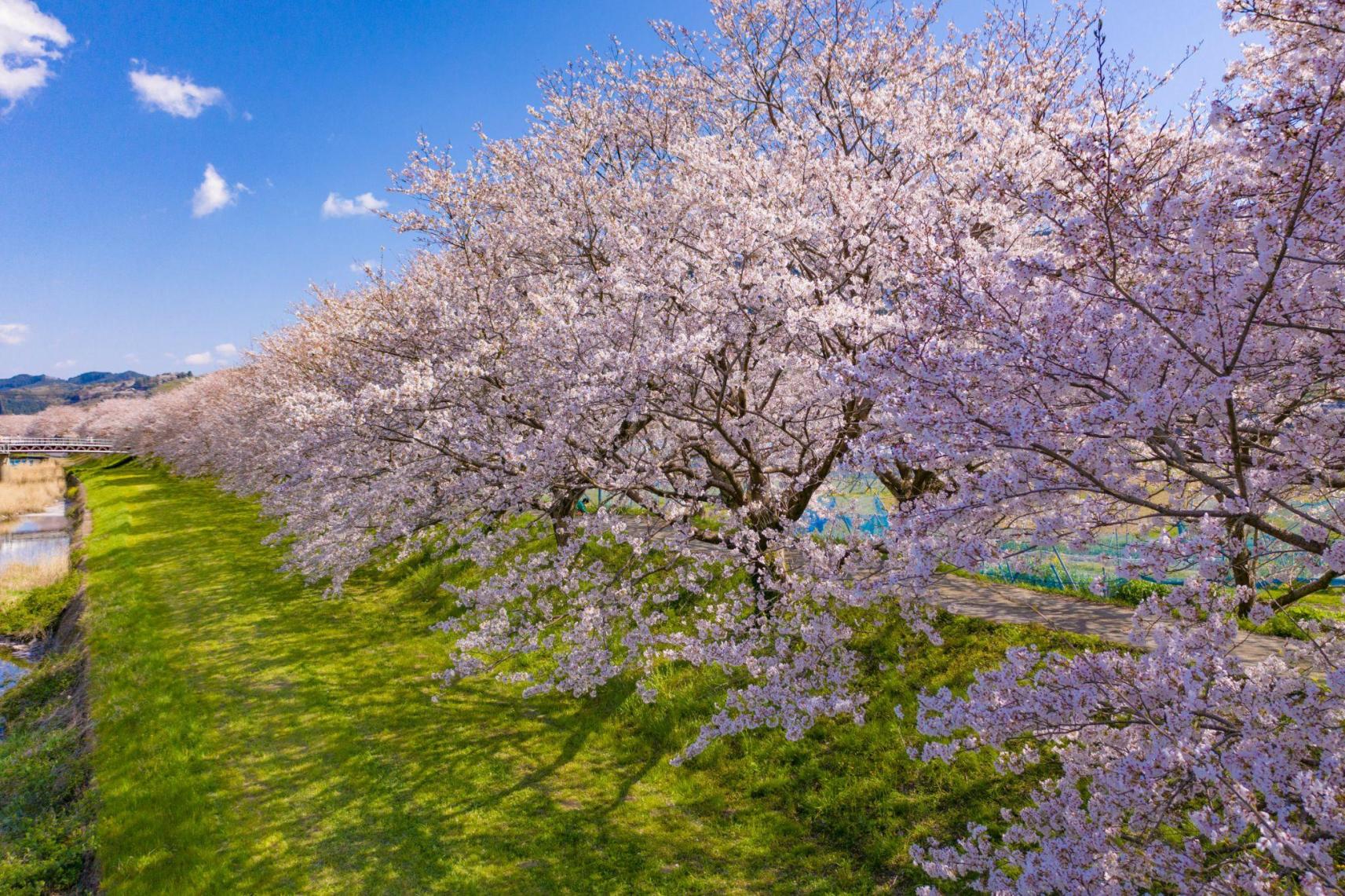
Ukiha, The Charming Spell Of The Countryside
-
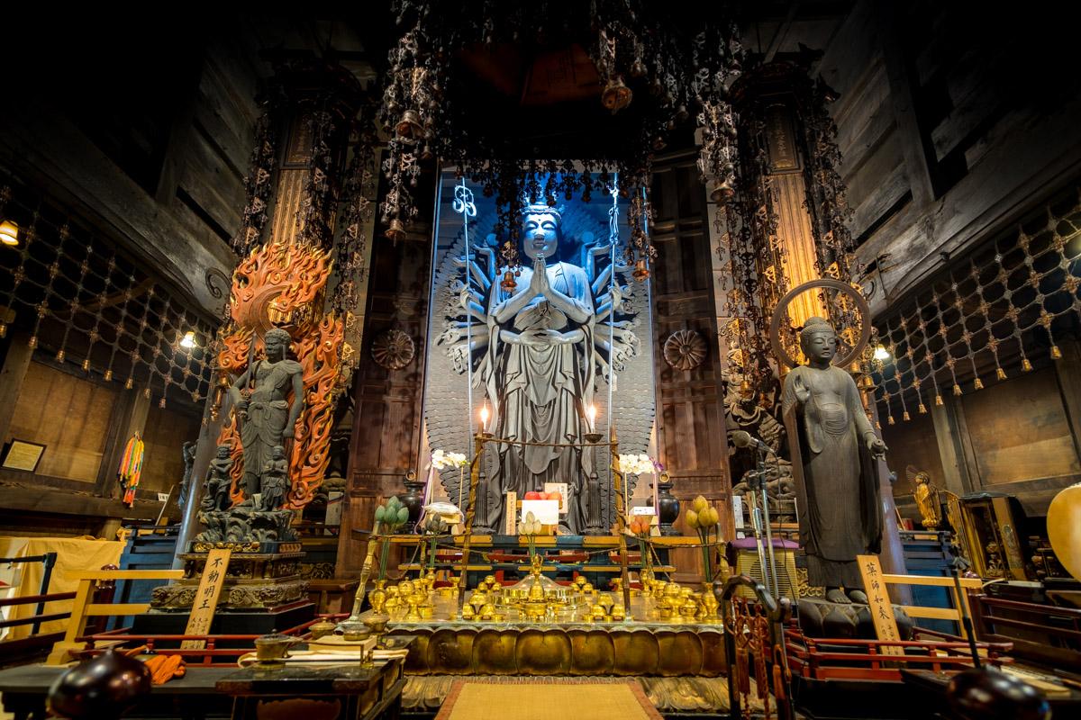
Raizan Sennyoji Daihioin Temple:
-
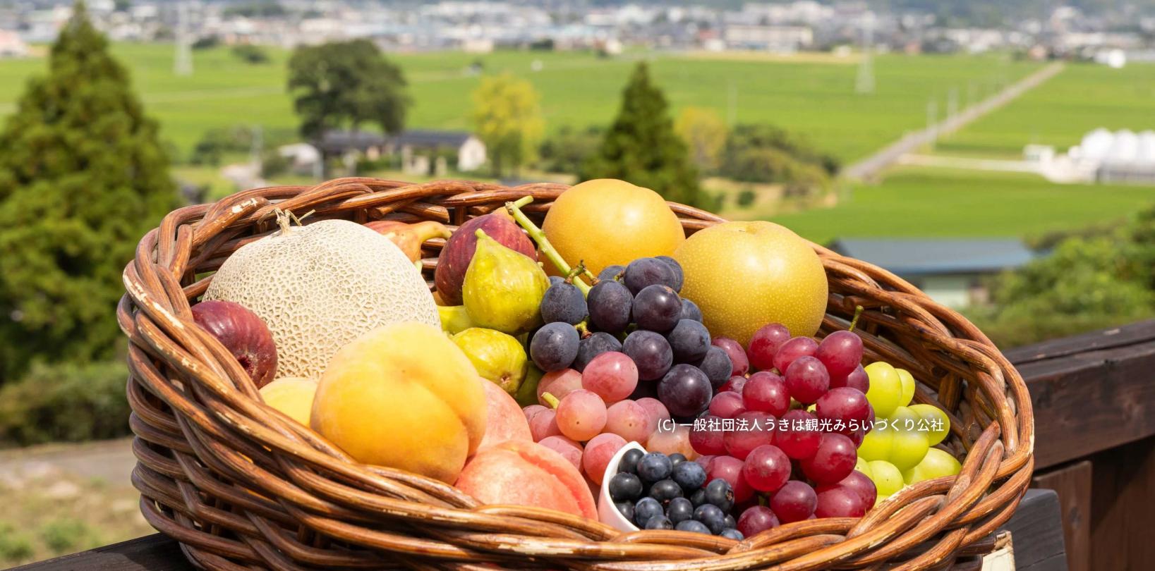
A guide to enjoying fruit picking in Fukuoka all year round! Featuring farms with all-you-can-eat options and attached cafes
-
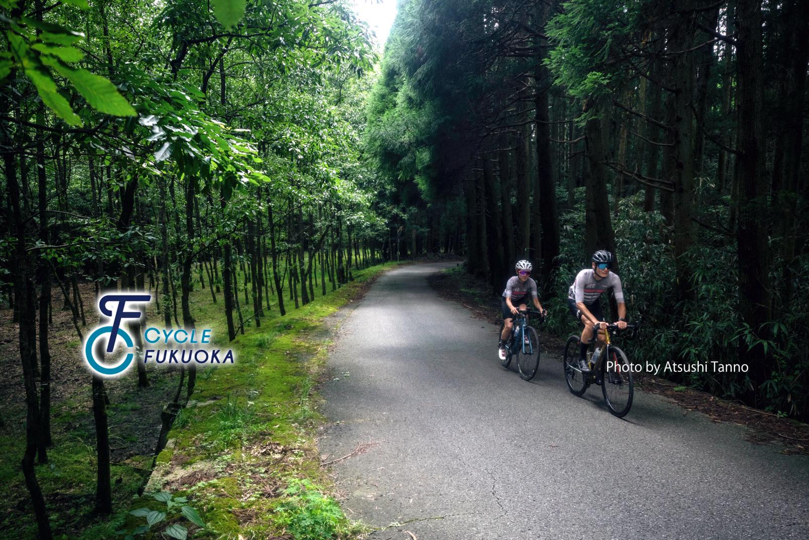
CYCLE FUKUOKA
-
Luxury accommodations in Fukuoka
-
【2025-2026】Illumination and Light-up Spots in Fukuoka
-
Rent a Car in Fukuoka! Introducing the Foreign Expressway Pass KEP